Black Mesa Summit Trail
Black Mesa Summit Trail
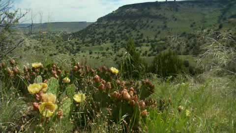
For a rewarding hiking experience, look no further than the Black Mesa Summit Trail. This trail will take you all the way to the top of Black Mesa, where you can stand at the highest point in Oklahoma - 4,973 feet above sea level. At 8.4 miles out and back, this is an intermediate to expert-level route with distinct elevation changes. Hikers find a combination of shortgrass prairie and foothills covered with juniper, shrub oak and cacti.
From the trailhead, head west, starting on a relatively flat stretch. The trail will stay flat, then start to slightly curve around to the southwest. At this point, the terrain becomes rocky, and you will begin to ascend the side of the mesa. About two miles into the trail, make a sharp turn, entering a series of switchbacks as you begin the 600-foot climb up the mesa. When you reach the top of the mesa, you'll begin the one-mile stretch to the summit marker. The trail will lead you to a granite monument that marks the Black Mesa summit and the highest point in the state. Take in the stunning view from the top, where you can see New Mexico and Colorado in the distance.
Photos


Videos